Maps and More
Dating back to Babylonian times, cartography is the practice of drawing maps. By relying on science, technique, and aesthetics, cartographers communicate complex spatial information in a way that is both visually pleasing and easier to comprehend. Maps may, for example, depict physical, political, topographic, climatic, or economic relationships. Beyond this, maps also serve as a record of our shared history. Maps may visualize any idea and its relationship to a physical place, illustrate changes to the world over time, provide a glimpse into how society once understood the world, and so much more.
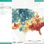
In recognition of the importance and versatility of the map, the Maps and More collection offers a diverse range of interactive resources. These maps provide a fascinating look into histories, personal stories, data, and research from across the world. Among the variety of maps offered, users can explore people and places of early modern London, the history of popular music genres, relationships between biodiversity and geography, open data, poverty in America, and the world
